NOTES ON THE CAMBODIA-VIETNAM BOUNDARY MAPS AND THE DELIMITATION 1985/2005 TREATIES.
6 November 2005.
Bora Touch Esq.
1. In 1993 HRH Norodom Sihanouk inserted at Article 2 of the 1993 Constitution the following stipulation:
“The territorial integrity of the Kingdom of Cambodia shall absolutely not be violated within its borders as defined in the 1:100,000 scale map made between the year 1933-1953 and internationally recognized between the years 1963 – 1969” (emphasis added).
2. His Majesty’s reference to the “1:100,000 scale map made between the year 1933-1953 and internationally recognized between the years 1963 – 1969” can be understood as follows.
3. The Cambodia-Thailand boundary (1:200,000 scale) maps were “made” in 1907, based on the 1904-1907 Treaty; however, the 1:200,000 maps were re-examined, re-verified, converted into a larger scale (1:100,000) and re-published in the early 1950s.
4. The Cambodia-Laos Boundary maps were prepared in the 1930s and “made” in 1940-1950 and based on French Decrees in 1904-1929.
5. The Cambodia – (French) Cochinchina boundary was prepared in 1913-1914 (Svay Reing-E), 1920 (Tay Ninh-Memot etc), 1930 Hatien-Kampot. The maps were re-examined and verified and “made” in 1951-53. They were based on the 1870-1873 Decrees and a Convention.
6. The Cambodia-Annam boundary maps were prepared in the 1920s (Yali sheet) and in 1930s (Poste Maitre). The maps were re-examined, re-verified by air photography and were re-made in 1940s-1950s based on French Decrees.
7. The colonial Service Géographique de l’Indochine (“SGI”) 1:100,000 maps are not all accurate, but the larger U.S. Army Topographic Command, known as the Army Map Service (“AMS”) 1:50,000, also contains errors such in Dak Dam, Ap Phuoc Thien, Bu Gia Map, Khum Trapeang Phlong, Tan Chau sheets. The difference is that the SGI 1:100,000 maps were made by more than one party, but AMS 1:50,000 maps were the product of the United States government alone.
8. In the 1950s, Cambodia corrected errors in some sheets of the SGI 1:100,000 maps. In 1964, Cambodia submitted these corrections to the United Nations. The changes were internationally recognized in 1963-1969, especially by Vietnam. It was these maps to which the UN Security Council Decision (Doc.S/5741) of 4 June 1964 referred.
9. Maps “made between 1933-1953”, according to some experts, is a reference to both the pre-1933 SGI 1:100,000 maps and the SGI 1:100,000 maps made between 1933 and 1953. These maps were re-examined, re-verified and republished between 1933 and 1953.
10. In light of the above explanation, the phrase “the 1:100,000 maps made between the year 1933-1953” is understandable and legally defensible.
The political significance
11. By 1933, Cambodia’s boundaries with its three neighbors had already been delimited. There is therefore no need to have the Delimitation Treaty 1985 and the Delimitation Supplementary Treaty 2005.
The loss of land.
12. On 13 June 2002, the Chairman of the Border Affairs Commission, H.E.Var Kim Hong reported to the National Assembly that based on the SGI 1:100,000 maps and those of the SGI 1:100,000 attached to the 1985 delimitation treaty, Cambodia lost 9,000 hectares; and based on the AMS 1:50,000 maps with those of 1:50,000 maps attached to the 1985 Treaty, Cambodia lost about 7,900 hectares.(Note: it is interesting that while H.E. Kim Hong was reporting on this particular points, Sok An coughed in an apparent attempt to interrupt him or to confuse the audience).
13. That said, before it can independently be ascertained whether Cambodia loses or gains land under the 1985 Treaty and the 2005 Supplementary Treaty, the relevant maps must be analyzed. The loss of land is to be compared with (a) the Cambodia’s internationally recognized (as corrected) boundary line of maps of 1964 which Cambodia submitted to United Nations and (b) Article 2 of the Constitution. In 1992, at the suggestion of the US State Department, Hun Sen gave all the “disputed” areas to Vietnam under the 1985 Treaty: See Nayan Chanda, “Land Erosion: Cambodians Question Status of Country’s Borders,”: Far. E. Econ. Rev., Sept.3, 1992.
I. Cambodia’s official Maps of 1964.
14. As mentioned above, in 1964, the Royal Government of Cambodia submitted to the United Nations and all relevant foreign governments, including North Vietnam, South Vietnam, Thailand and Laos the following officially corrected pages of maps of 1:100,000 maps (“1964 maps”).
15. There are all 26 sheets made between 1933-1953:
SGI 1:100,000 Scale maps:
Sheet Name: Sheet No: Province:
1.Dak To, 148-W, Ratanakiri
2.Yali, 156 -W, Ratanakiri
3.Bo Kham, 164-W, Ratanakiri
4.Bo Kham, 164-E, Ratanakiri
5.Ko Mayon, 172-E, Mondulkiri
6.Ko Màyon, 172-W, Mondulkiri
7.Bandon, 181-W, Mondulkiri
8.Bandon, 181-E, Mondulkiri
9.Poste-Maitre, 192-E, Mondulkiri
10.Poste-Maitre, 192-W, Mondulkiri
11.Sre Khtum, 191-E, Mondulkiri
12.Loc Ninh, 201-E, Kratie
13.Loc Ninh, 201-W, Kratie-Kampong Cham
14.Memot , 200-E, Kampong Cham
15.Memot , 200-W, Kampong Cham
16.Tay Ninh, 210-E, Kampong Cham
17.Tay Ninh, 210-W, Svay Rieng
18.Prey Veng, 209-E, Prey Veng
19.Trang Bang, 220-W, Svay Rieng
20.Trang Bang, 220-E, Svay Rieng
21.Svay Rieng, 219-E, Svay Rieng-Prey Veng
22.Svay Reing, 219-W, Prey Veng-Kandal
23.Takeo, 218-E, Kandal-Takeo
24.Hatien, 227-E, Takeo
25.Hatien, 227-W, Takeo-Kampot
26.Kampot, 226-E, Kampot.
16. The Royal Government of Cambodia (H.E. Var Kim Hong) had obtained a copy of the corrected maps from the United Nations and the Library of Congress (US) in 1994. In other words, the Government has a copy of these corrected maps in its possession.
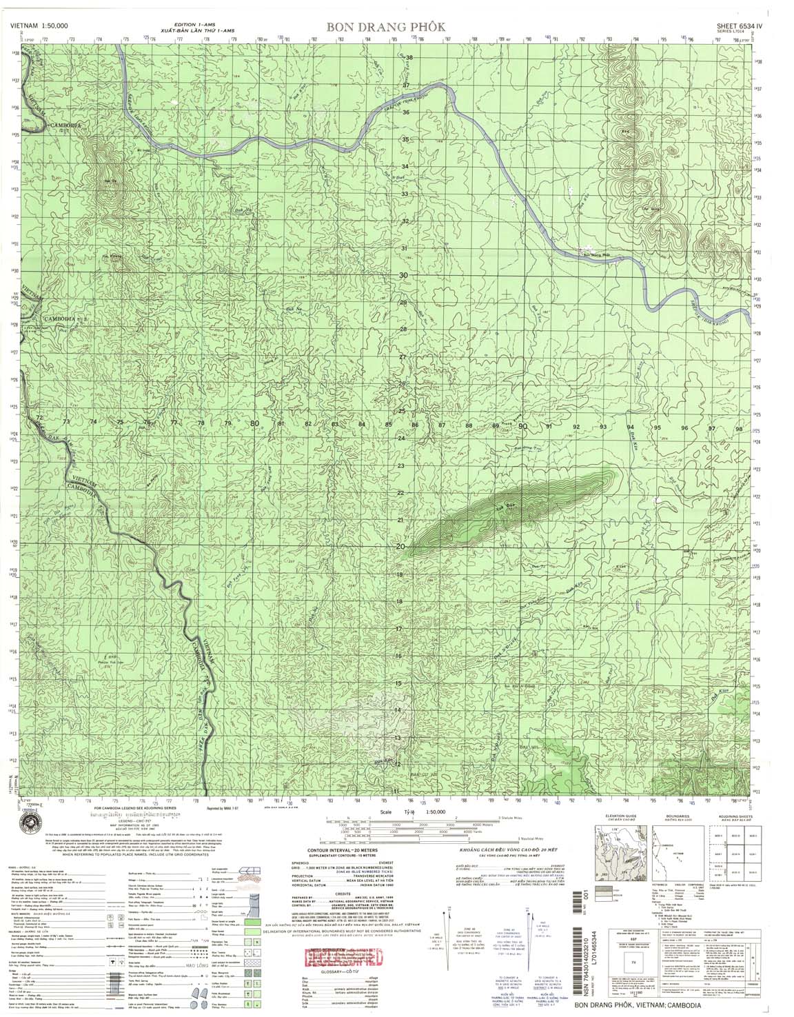
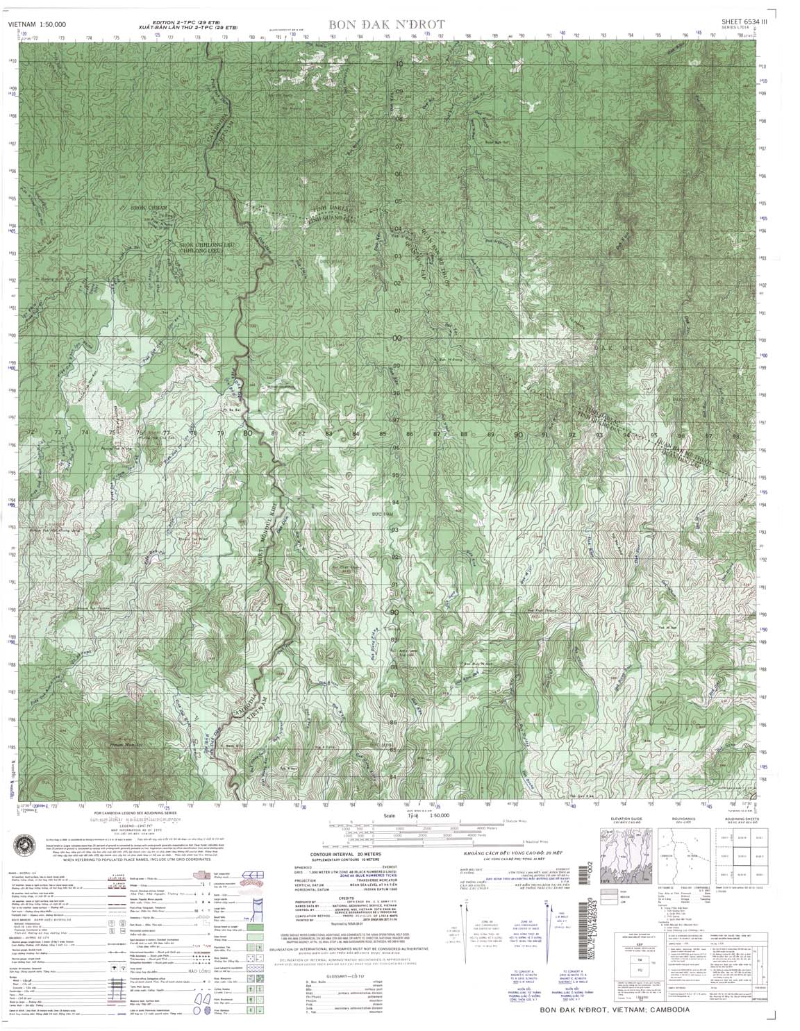
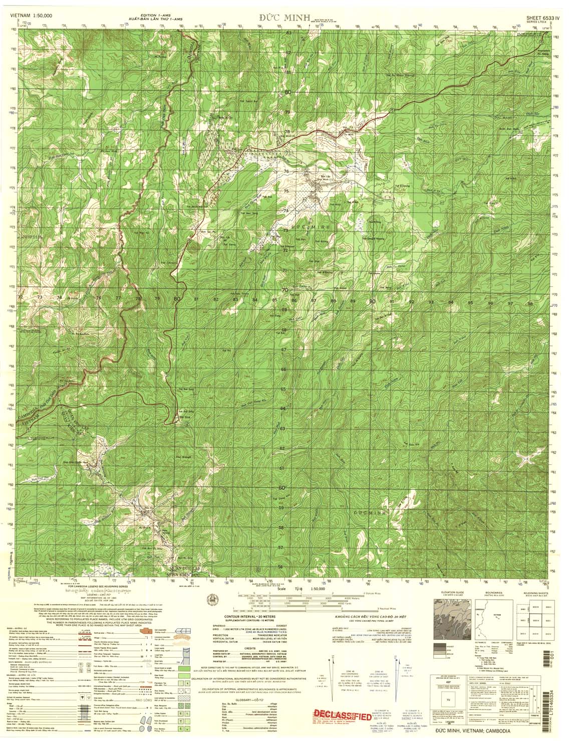
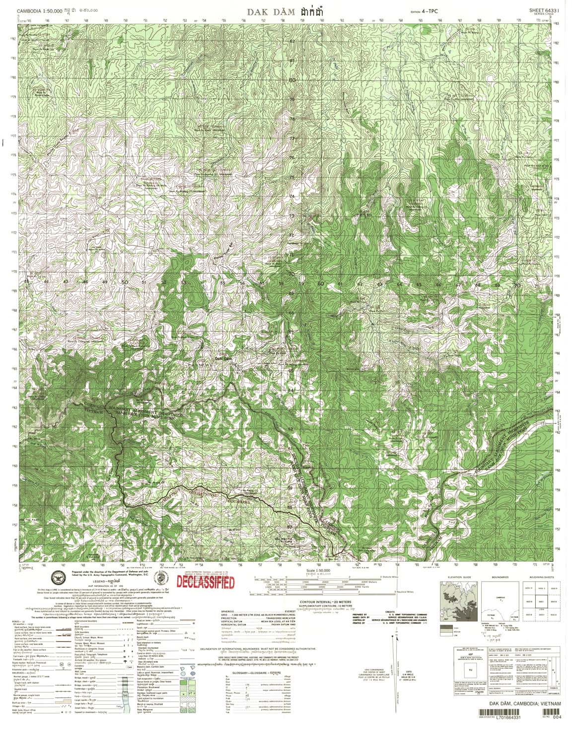
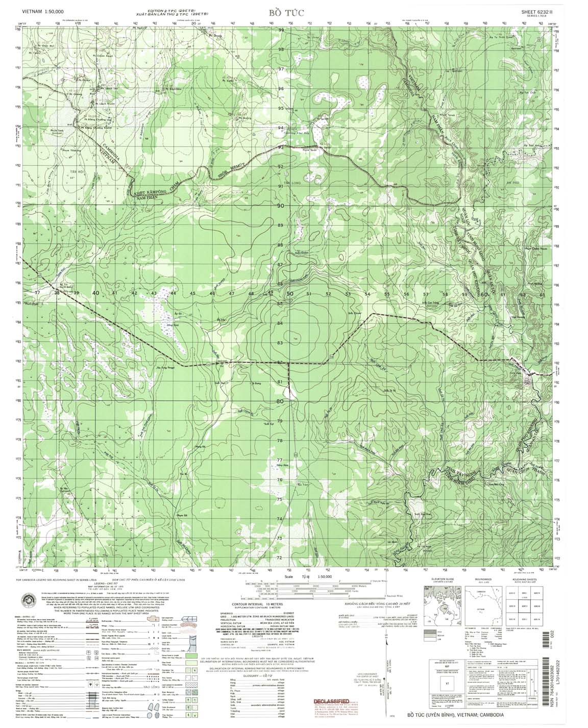
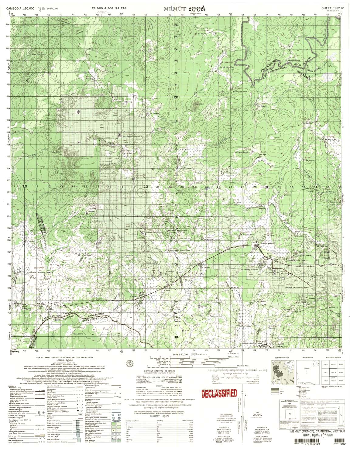
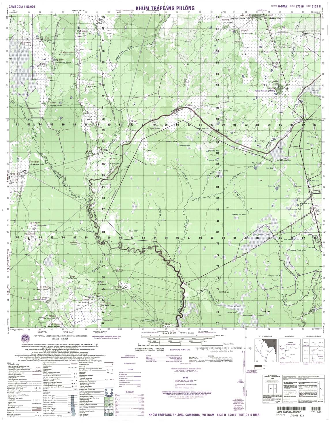
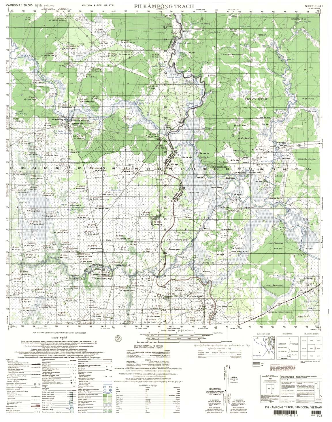
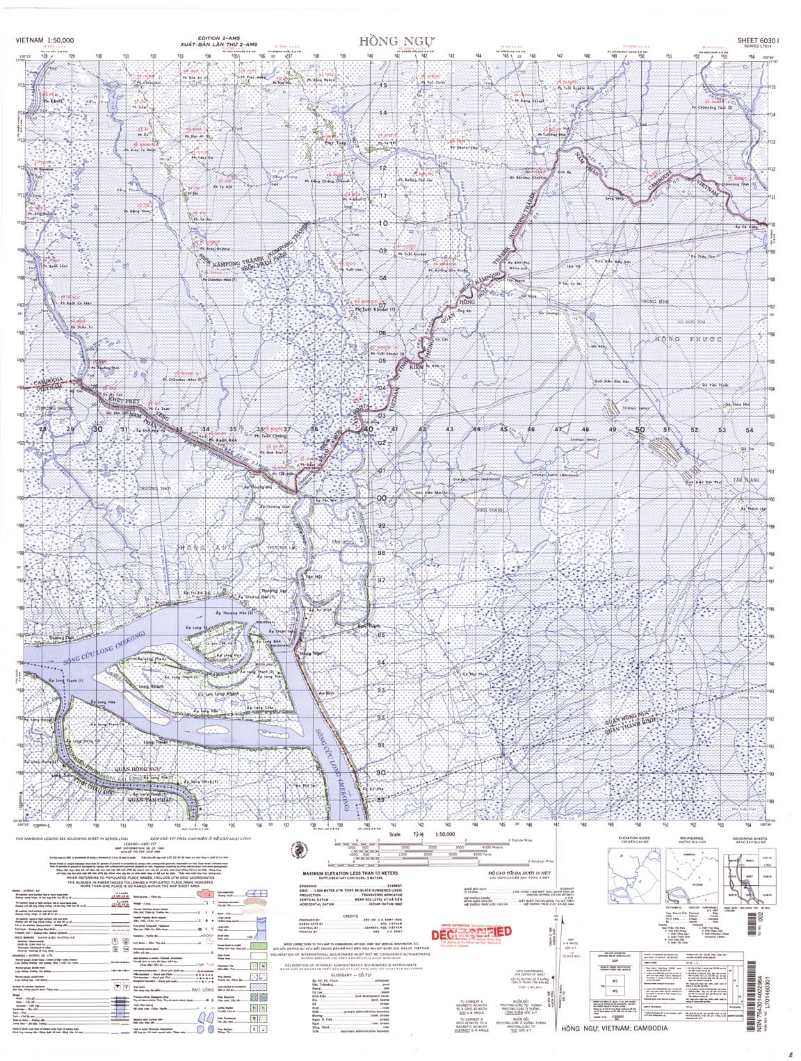
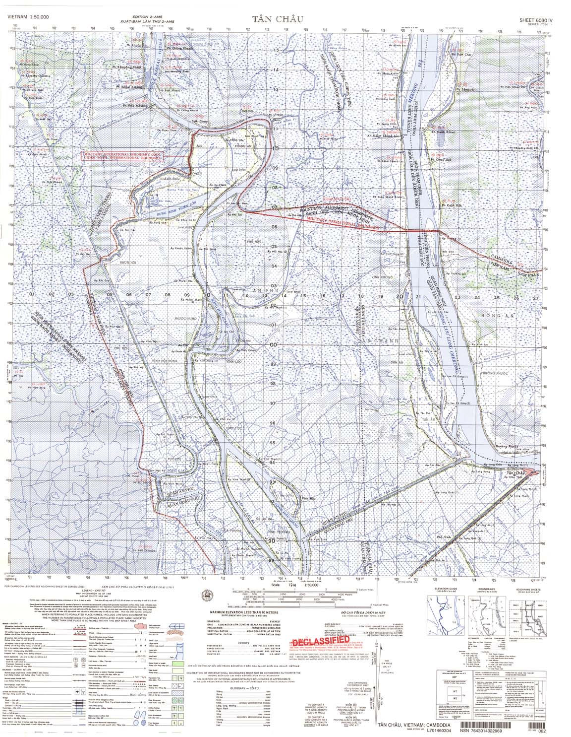
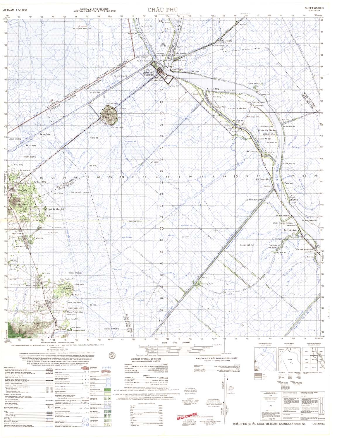
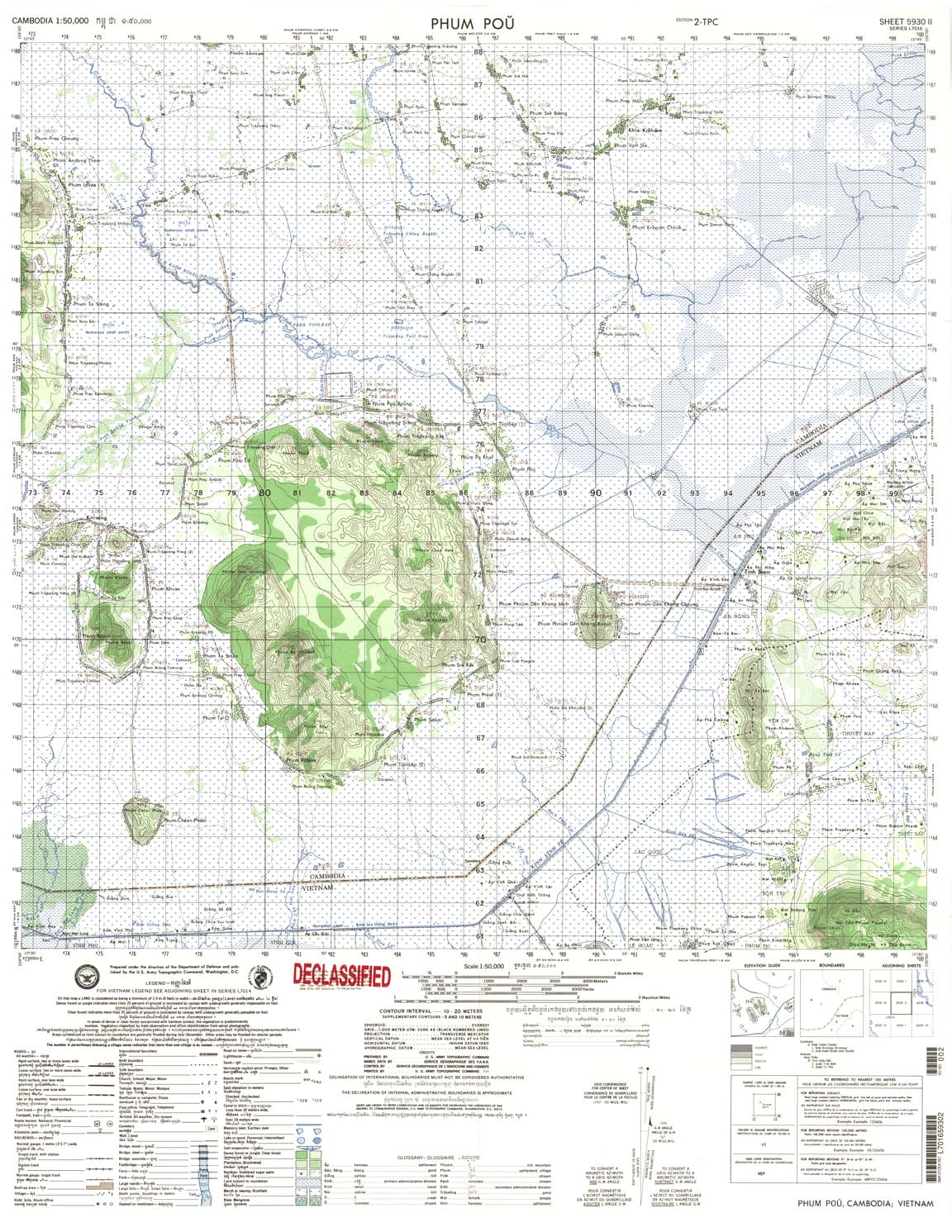
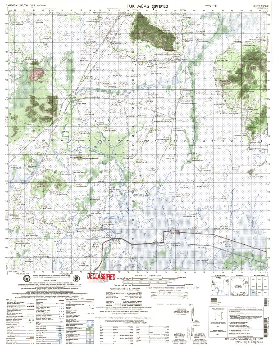
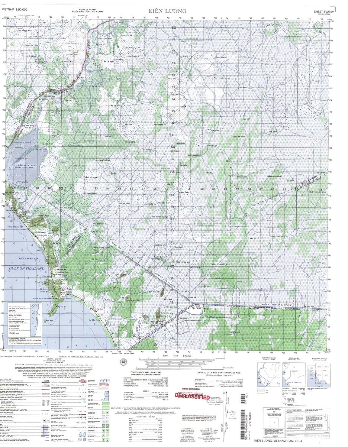
17. The 40 sheets of maps of a scale of 1:50,000 were made by the AMS between 1966 to 1970. As mentioned above, in the 1960s, Cambodia rejected them because certain sheets contained errors in favor of South Vietnam (then closely allied to the US). However, the AMS did provide qualifications on these sheets when it believed that the relevant section of the boundary was indefinite or undefined by indicating the relevant section with a red line and a statement “boundary alignment indefinite”. The red line generally means the land was claimed by Cambodia in accordance with the 1964 maps and recognized by Communist Vietnam on 15 August 1966 and 31 May 1967 and 10 June 1969.
II. The AMS 1:50,000 Scale Maps, (40 sheets):
18. (Note: when these maps were produced in 1966-67, they were in format L 7011. They were revised after 1967 to conform with a 15’ by 15’ format, L 7017)
Sheet Name Sheet No. Production date.
1.Dak Mot Lop, 6538 –III, 1966
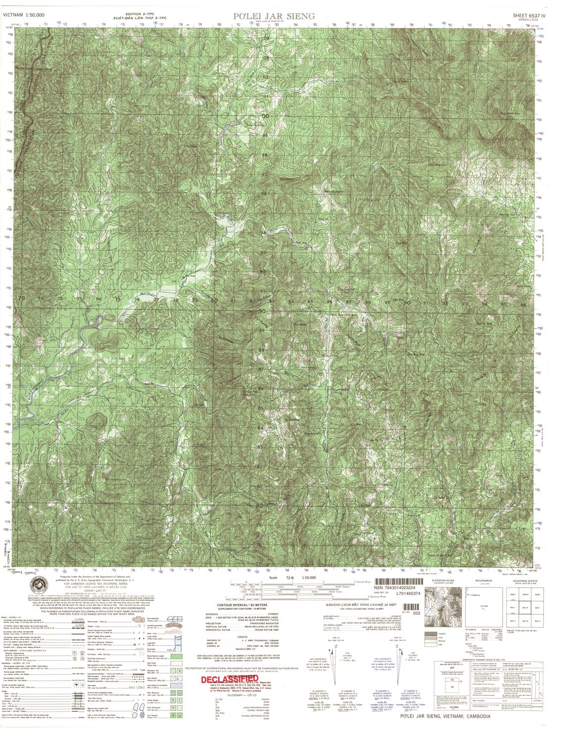
2.Polei Jar Sieng, 6537-IV, 1966
3.Phum Kham Dorang, 6437 -I, 1966
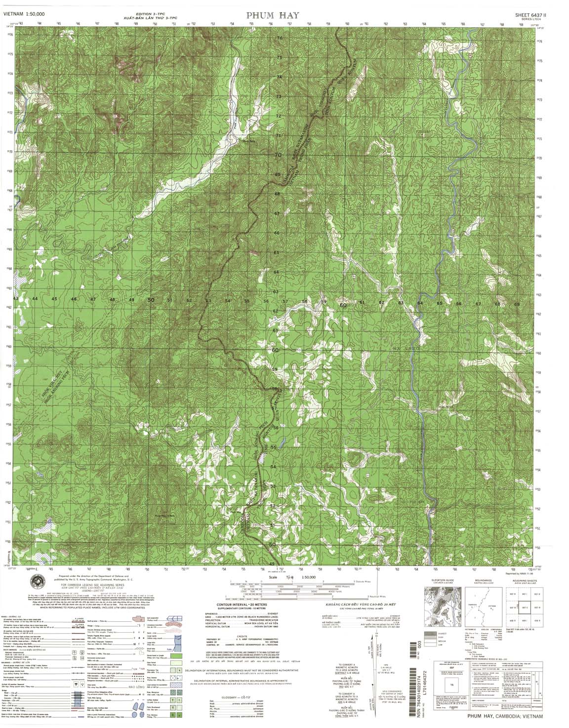
4.Phum Hay, 6437-II, 1970
5.Phum Thong, 6436-I, 1966
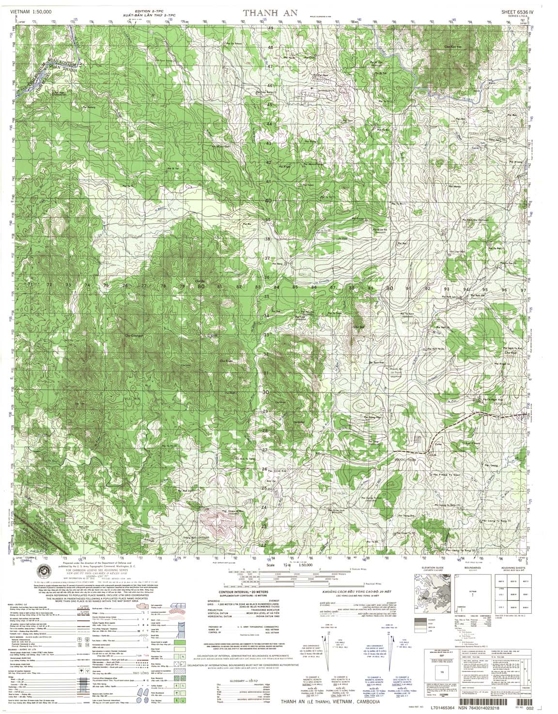
6.Le Thanh, 6536-IV, 1966
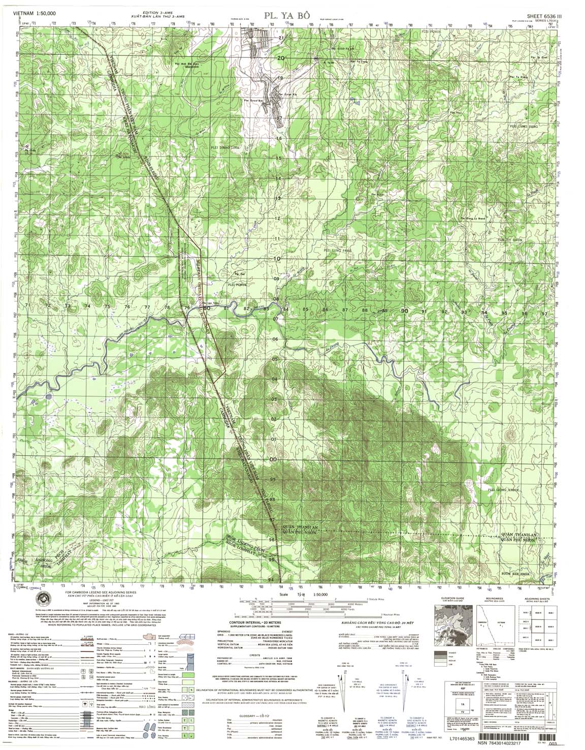
7.Pl. Ya Bo, 6536-III, 1966
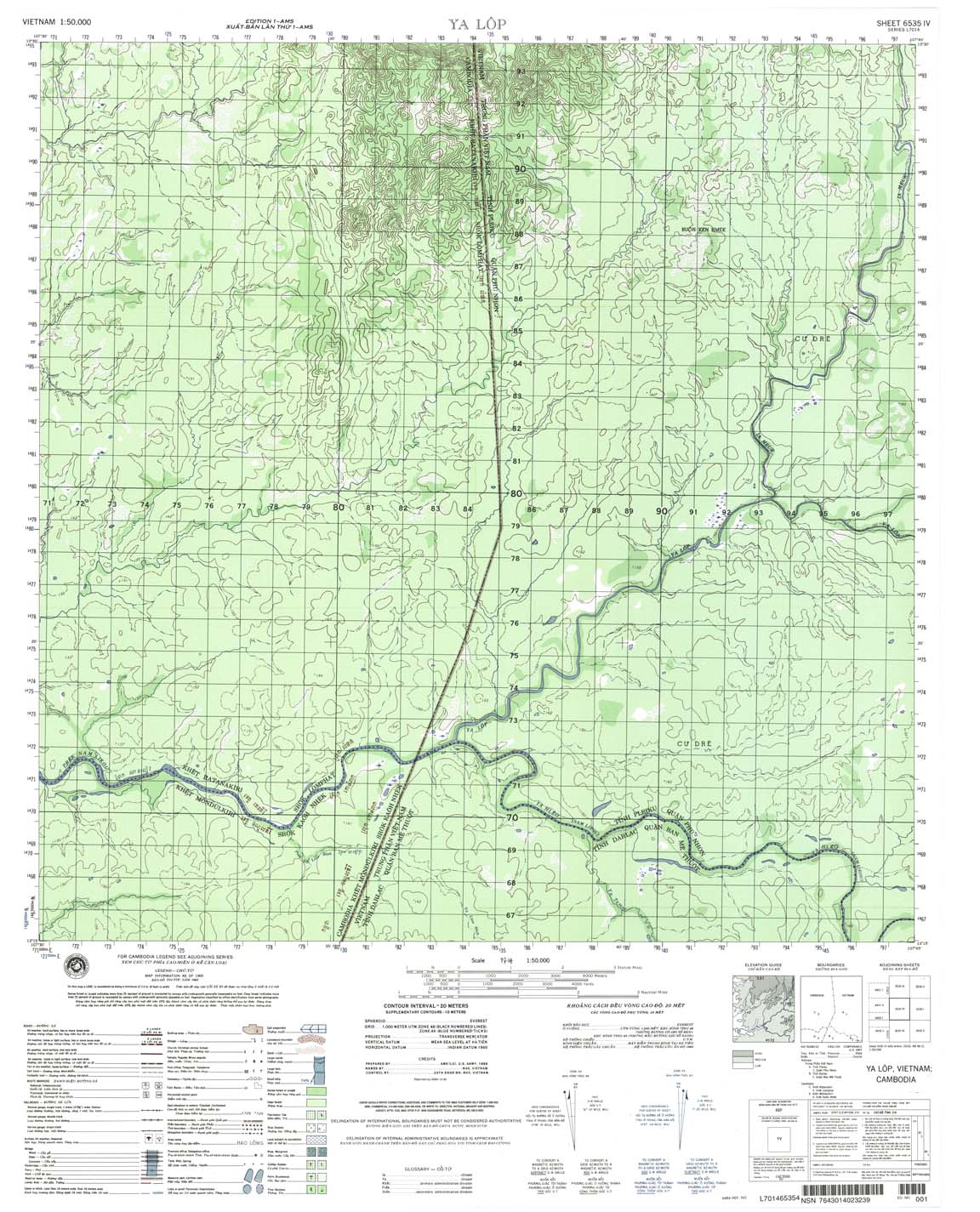
8.Ya Lop, 6535-IV, 1966
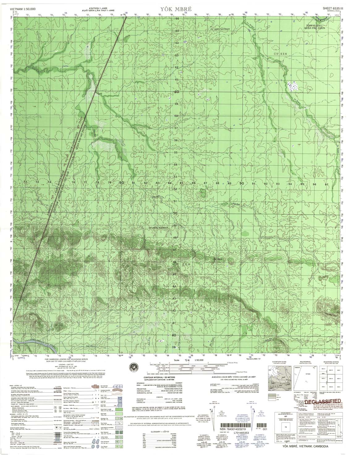
9.Yok Mbre, 6535-III, 1966
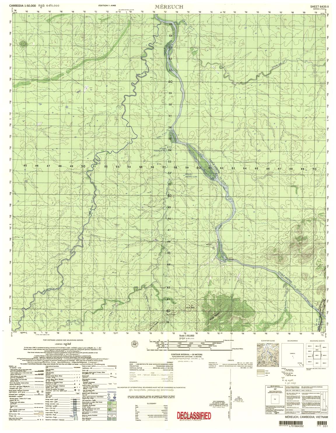
10.Mereuch, 6435-II, 1966
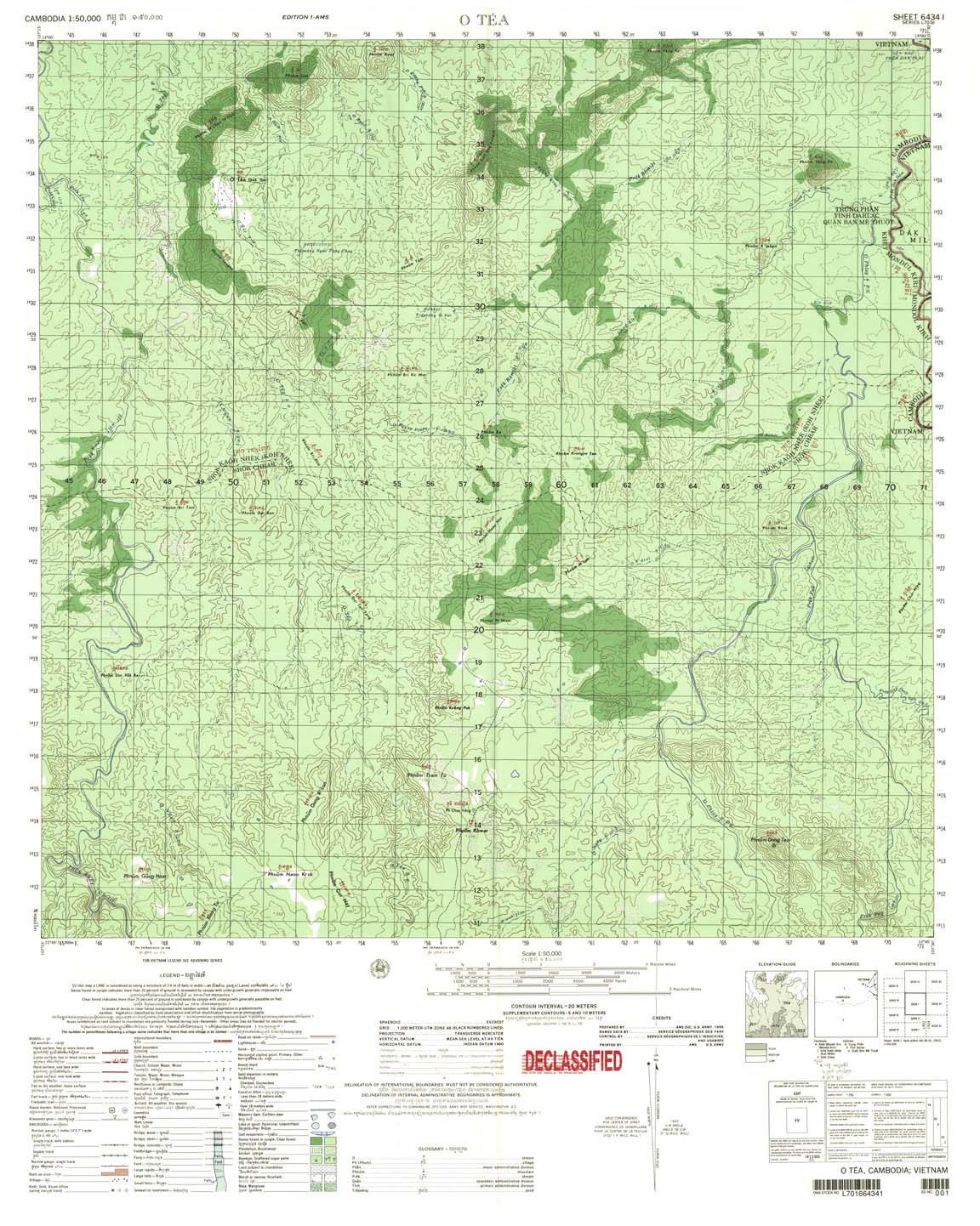
11.O Tea, 6434-I, 1966
12.Bon Drang Phok, 6534-IV, 1966
13.Bon Dak N’Drot, 6534-III, 1966
14.Duc Minh, 6533-IV, 1966
15.Dak Dam, 6433-I, 1966
16.Ap Doan Van, 6433-II, 1966
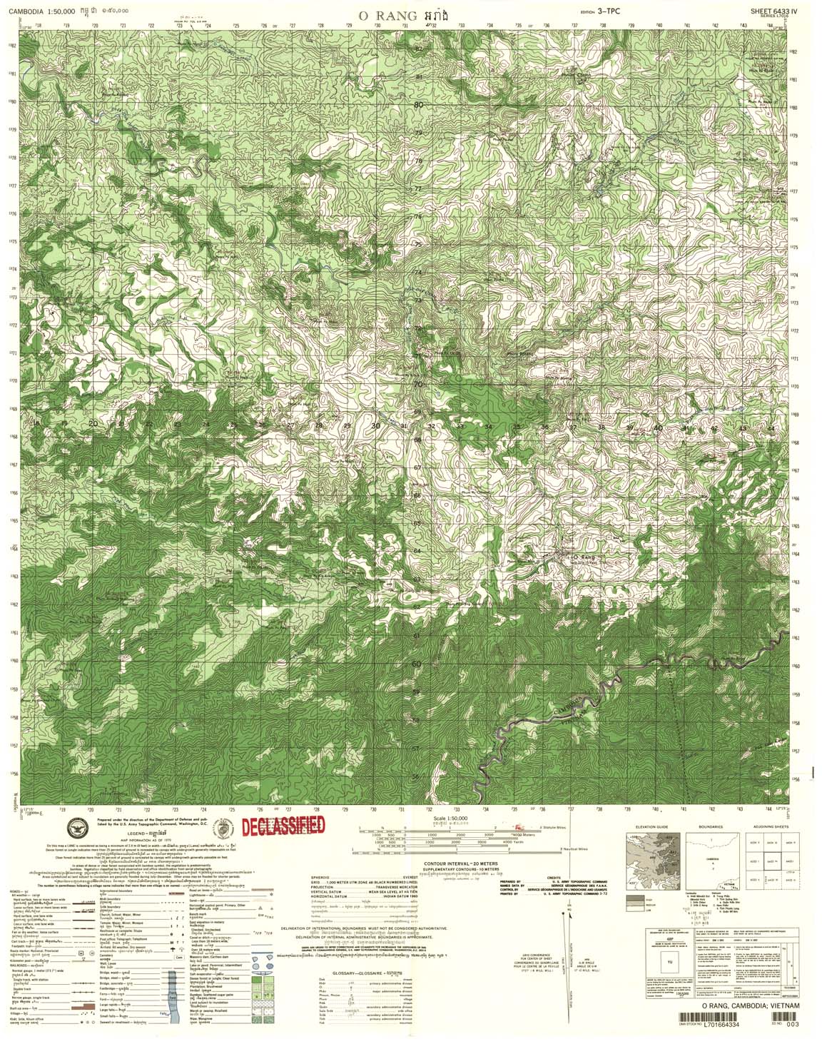
17.O Rang, 6433-IV, 1966
18.Bu Gia Map, 6433-III, 1966
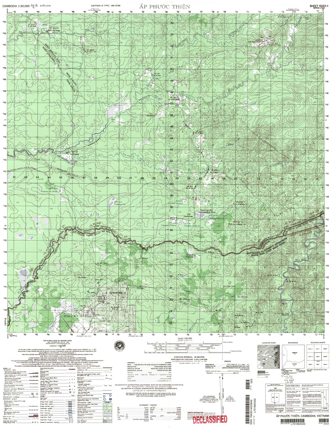
19.Ap Phuoc Thien, 6333-II, 1971
20.Meak Say, 6333-III, 1967
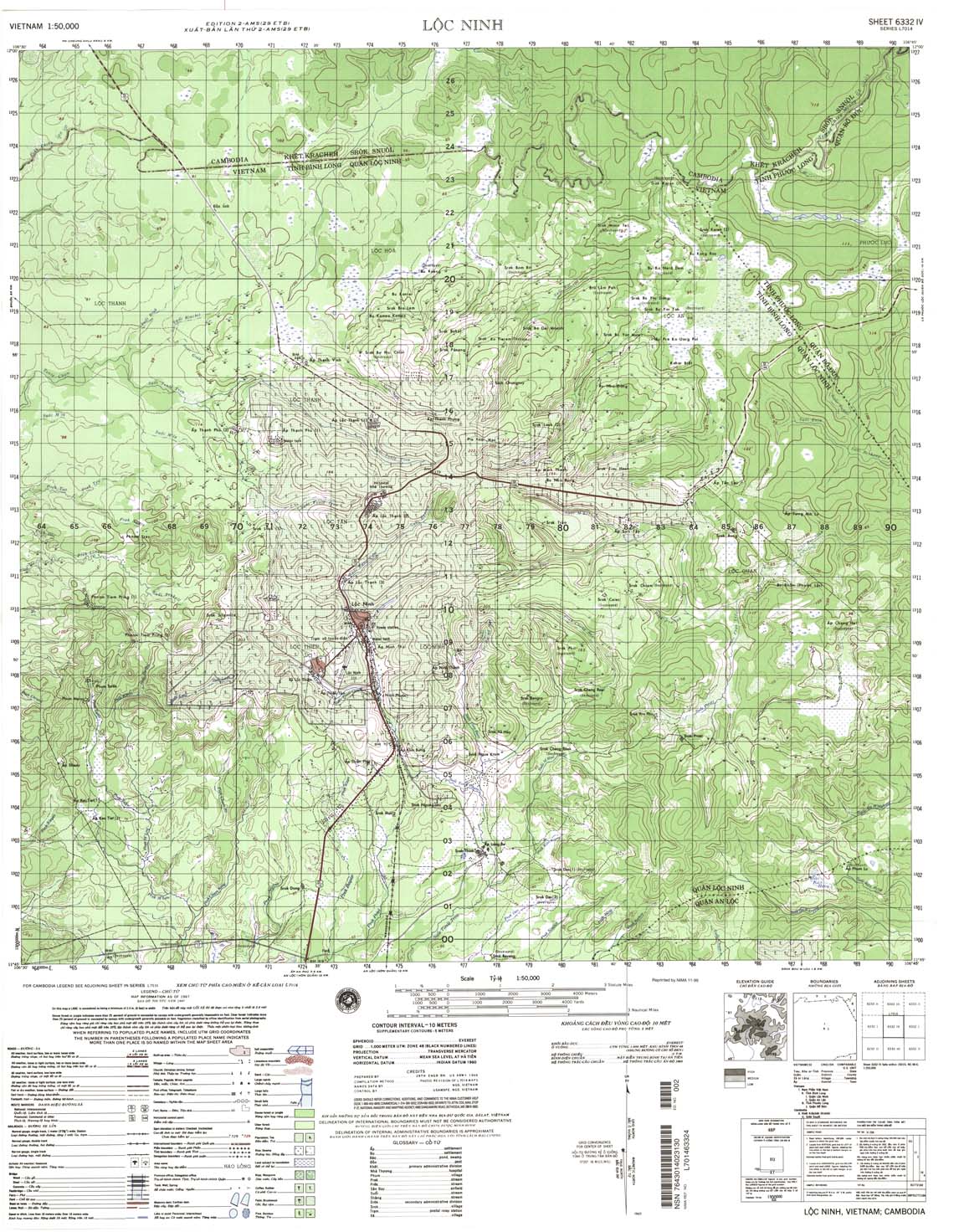
21.Loc Ninh, 6332-IV, 1968
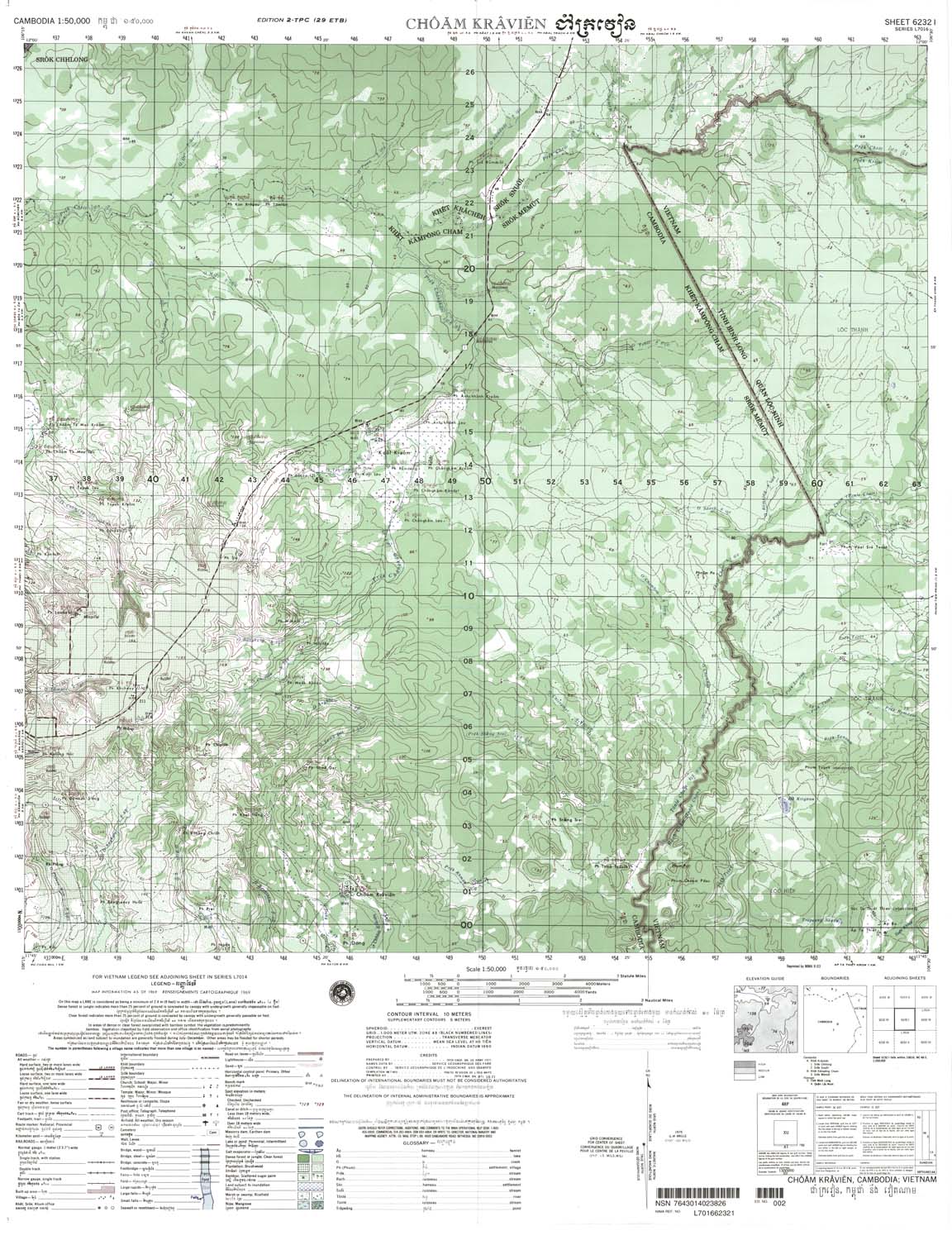
22.Choam Kravien, 6232-I, 1971
23.Bo Tuc, 6232-II, 1966
24.Ta Dath, 6232-III, 1968
25.Me Mut, 6232-IV, 1971
26.Khum Tranpeang Phlong, 6132-II, 1966
27.Phum Kampong Trach 6131-I, 1970
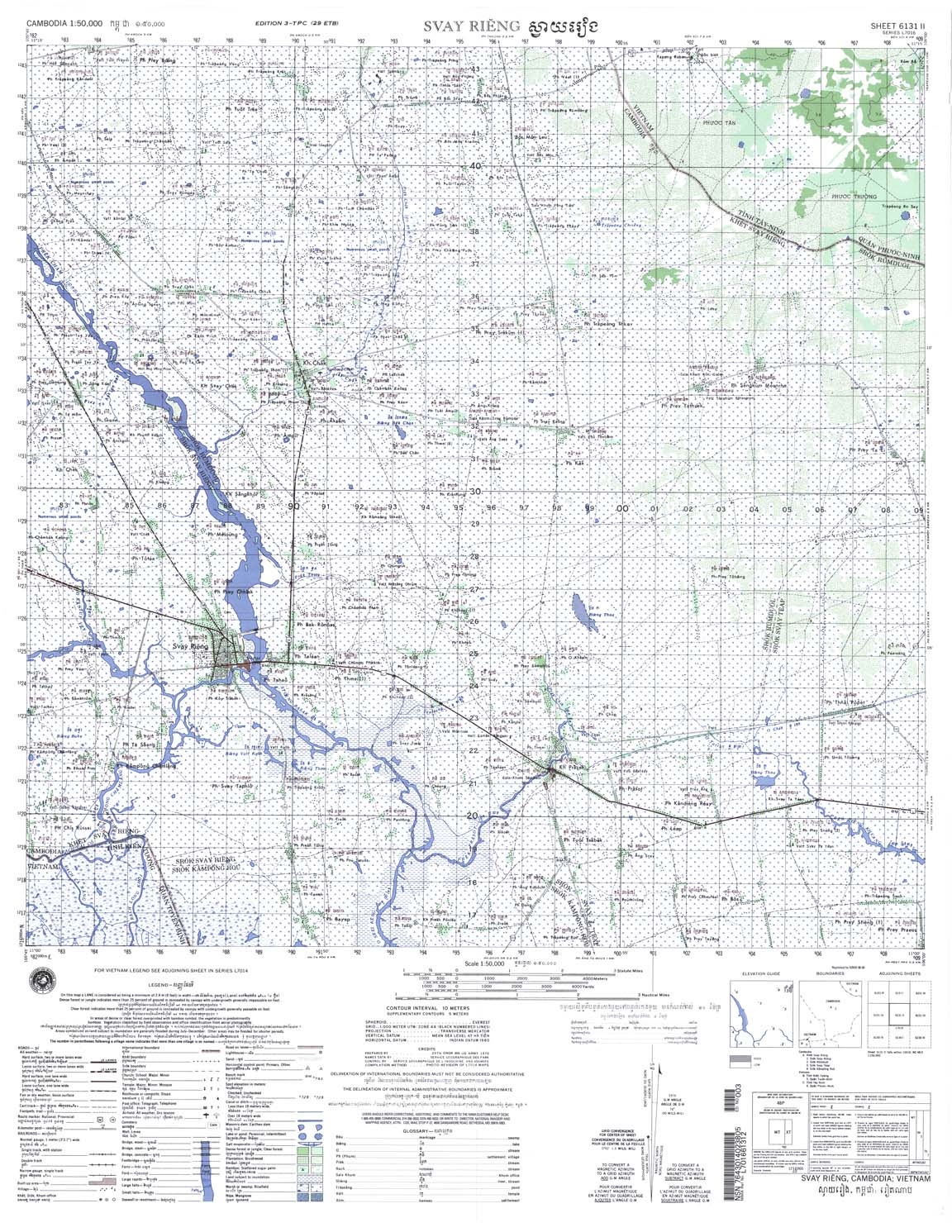
28.Svay Rieng, 6131-II, 1970
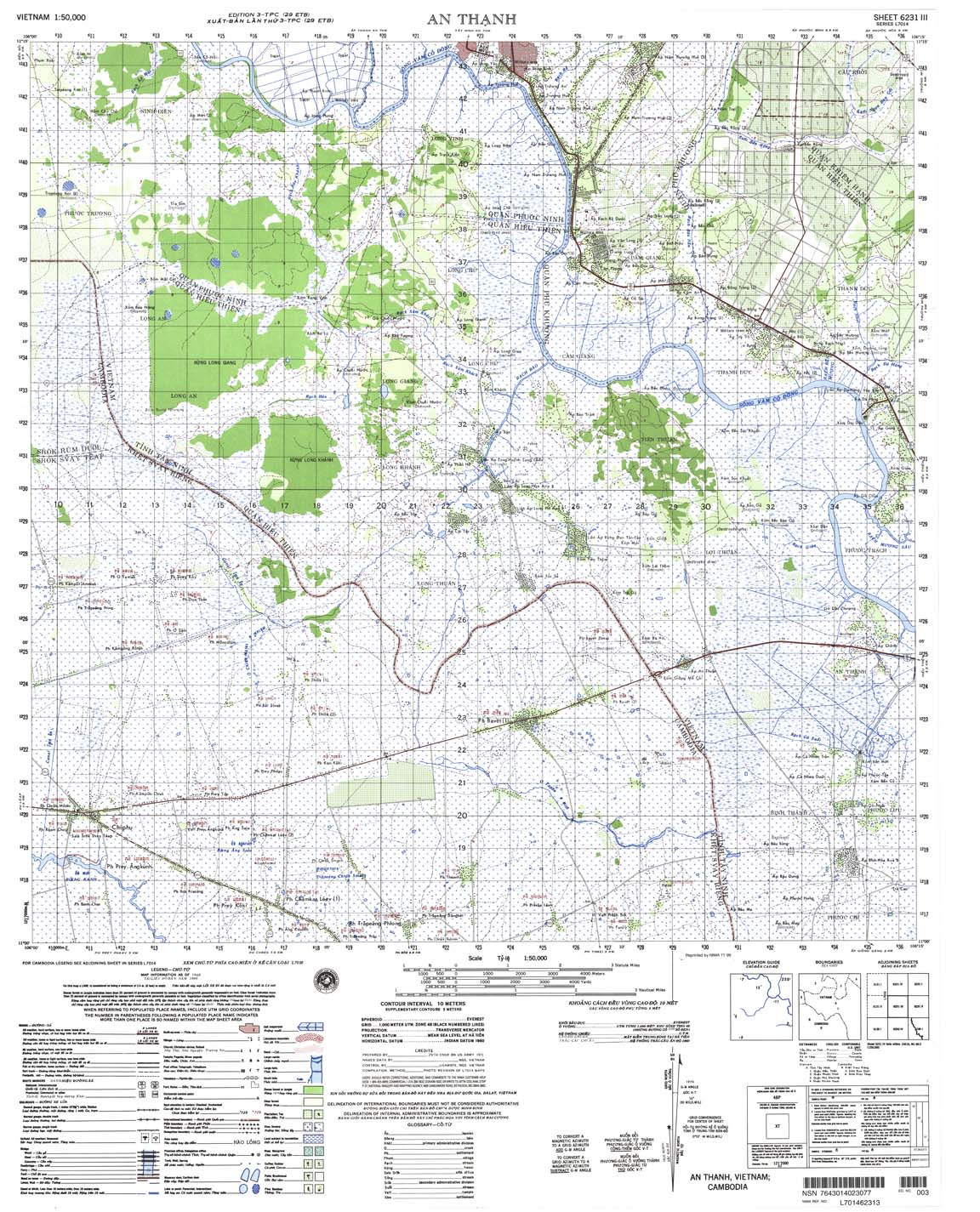
29.An Thanh, 6231-III, 1969
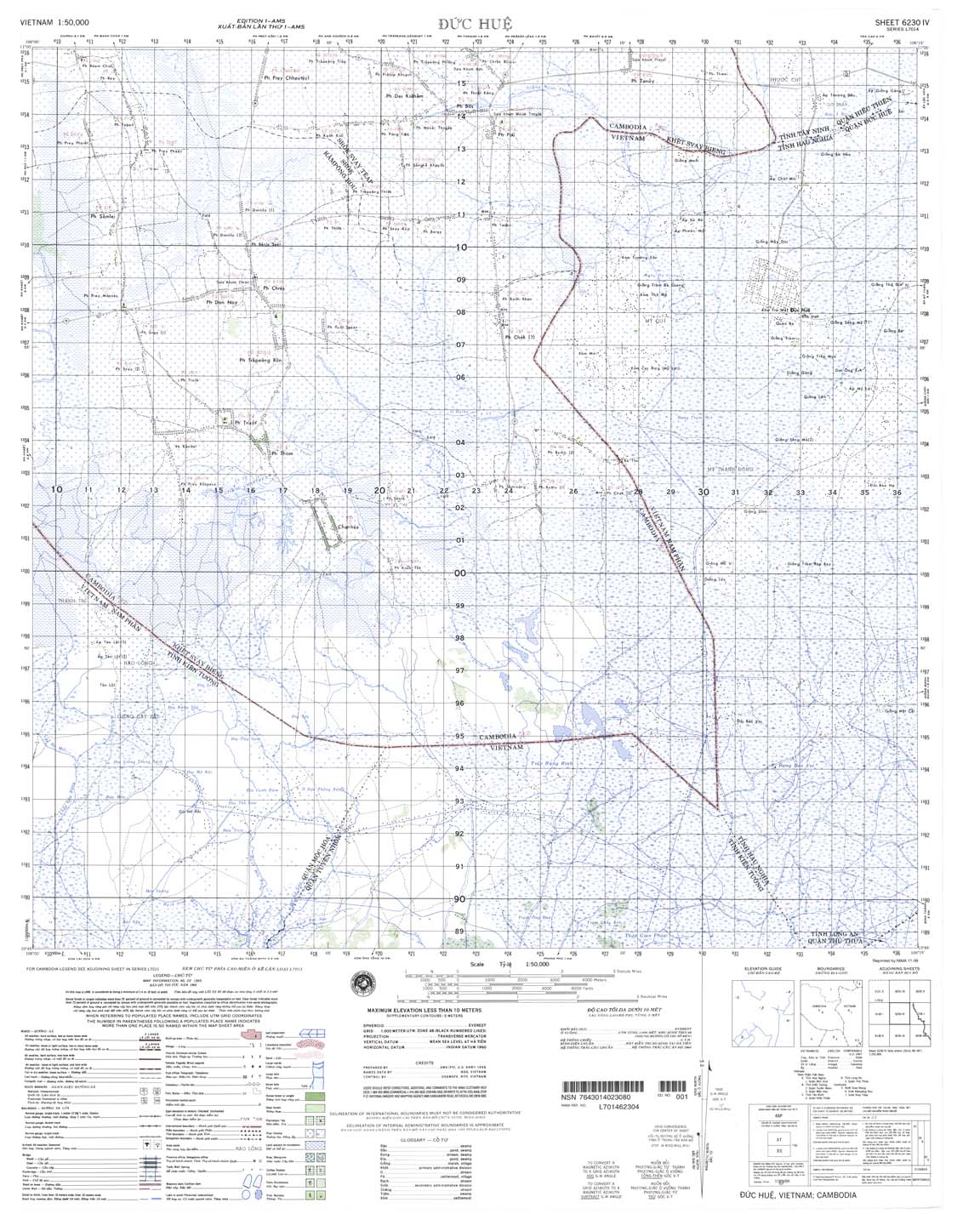
30.Duc Hue, 6230-IV, 1966
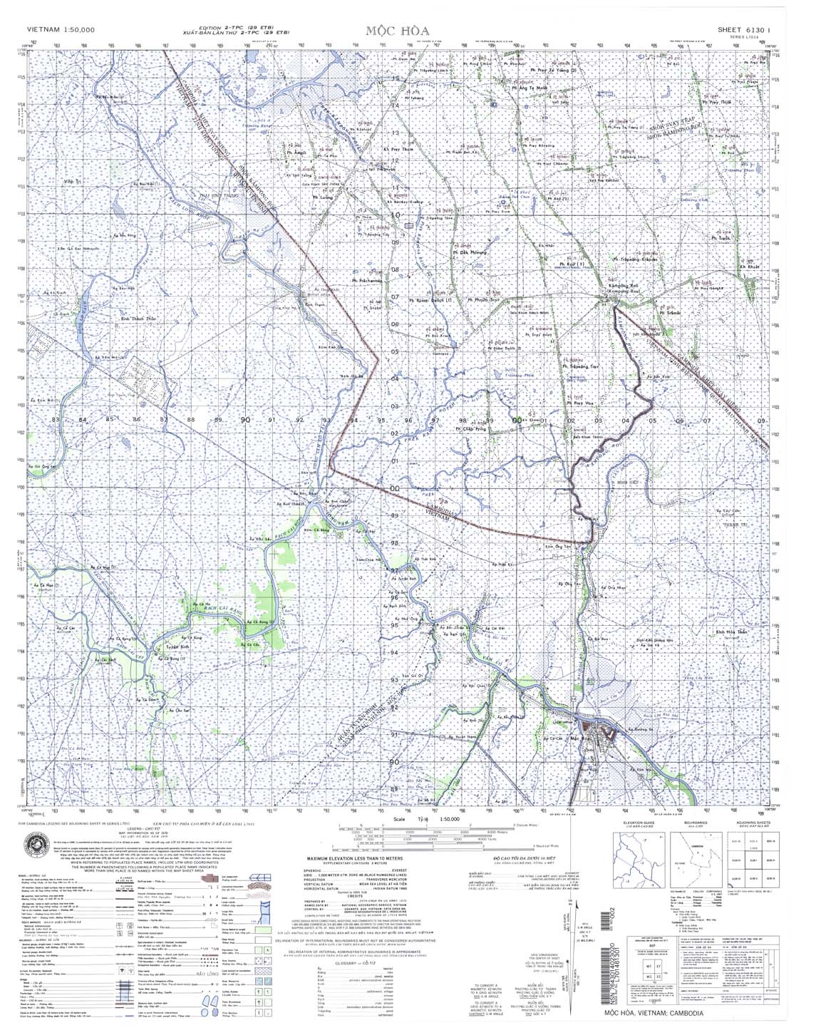
31.Moc Hoa, 6130-I, 1966
32.Prey Nhay, 6131-III, 1966
33.Vinh Thang, 6130-IV, 1966
34.Hong Gnu, 6030-I, 1966
35.Tan Chau, 6030-IV, 1966
36.Chau Phu, 6030-III, 1970
37.Tinh Bien, 5930-II, 1971
38.Tuk Meas, 5930-III, 1971
39.Kien Luong, 5929-IV, 1966
40.Krong Kep, 5829-I, 1966
III. Maps attached to the 1985 Treaty.
19. There are two sets of maps attached to this Treaty: (a) AMS 1:50,000 scale maps, and (b) SGI 1:100,000 maps. (Note that it would be useful to see the 1:25,000 scale “confidential” map made by the parties to the1985 Treaty based on the two maps referred to in (a) and (b) above.) The same sheet names of the SGI 1:100,000 maps above were used for the boundary alignments drawn under this 1985 Treaty, although new alignments were adjusted in favor of Vietnam ignoring the alignments as corrected by Cambodia in 1964.
20. The SGI 1:100,000 maps below are maps stipulated in the Statistics of 1:100,000 scale Maps, “Attachment I”, 26 Sheets Which Both Parties agreed to use, Verified and Signed” dated 26 October 1985. These maps were not deposited with the UN and they are still classified as “Confidential.”
21. The 26 Sheets of SGI 1:100,000 are:
Sheet Name. Sheet No. Production Date Remarks
1. Dac To-W, 148-W 1954-9 (Interim Map)
2. Yali-W, 196-W 1955-9 — (SthVN)
3. Bokham-W, 164-W 1954-3 —
4. Bokham-E, 164-E 1953-10 —
5. Komayon-E, 172-E 1953-9 —
6. Komayon-W, 172-W 1952-5 — (Bonne)
7. Bandon-W, 181-W 1953-4 (Official)
8. Bandon-E, 181-E 1953-11 —
9. Poste Maitre-E, 192-E 1953-10 —
10. Post Maitre-W, 192-W 1953-10 —
11. Sre Khtum-E, 191-E 1953-10 (Interim Map)
12. Loc Ninh-E, 201-E 1951-10 (Official)
13. Loc Ninh-W 201-W 1953-2 —
14. Mimot-E, 200-E 1951-10 —
15. Tay Ninh-E, 210-E 1951-11 —
16. Mimot-W, 200-W 1951-10 —
17. Tay Ninh-W, 210-W 1951-11 —
18. Prey Veng-E, 209-E 1952-6 —
19. Trang Bang-W, 220-W 1952-1 —
20. Trang Bang-W, 220-E 1952-2 —
21. Svay Rieng-E, 219-E 1951-2 —
22. Svay Rieng-W, 219-W 1951-2 —
23. Takeo-E, 218-E 1951-9 —
24. Hatien-E, 227-E 1953-1 —
25. Hatien-W, 227-W 1953-1 —
26. Kampot-E, 226-E 1951-1 —
22. Set out below are the 40 sheets that are also attached to the 1985 Treaty. These sheets are listed in the Statistic of 1:50,000 Scale Maps, “Attachment II”, Containing 40 Sheets Which Both Parties Agreed, Verified and Signed, dated 26 October 1985.
Sheet Name Sheet No. Production date. Remarks.
[(*). Indicates a difference from the US Army Map Service first date of production. Also see the attached official document to 1985 Treayt-26/10/85.
(**). Duc Hue and Bo Tuc sheets that were made in 1966 by AMS are more accurate than the Duc Hue and Bo Tuc sheets made by the South Vietnamese Army. Perhaps this was why they were used for this 1985 Treaty.
Of note, there are 210 identifying points or coordinates from the dragon tail to the land boundary isthmus, (Krong Kep), but, strangely, the 1985 Treaty provides no identification points/coordinates at the dragon point and the isthmus. Does this mean to give the parties the opportunity to have joint ownership?]
23. In examining these sheets, one needs to bear in mind the relevant map-makers. South Vietnam had reproduced it own 1:50,000 map sheets which, in most cases, do not show the qualifications or disclaimers such as “boundary alignment indefinite” or “ Military Operational Boundary” in indicating with red line as appears on AMS sheets.
24. The US Army’s sheets do show these qualifications. After North Vietnam took over the South in 1975, in this regard, their attitude and conduct are the same as South Vietnam’s.
25. Additionally, the Royal Government’s corrected SGI 1:100,000 map sheets of 1964 to the UN show “definite” and clear boundary lines.
3. Maps of Supplementary Convention 2005.
(To obtain the relevant documents, click here:
http://ia300102.us.archive.org/2/items/Border_Document_No._1/FinalSuppTreatyKhmer.pdf
http://ia300117.us.archive.org/2/items/Border_Document_No._2/FinalSuppTreatyOfficialFrench.pdf
http://ia300108.us.archive.org/2/items/Border_Document_No._3/MapsSuppTreaty.pdf
26. These six sheets attached to the Supplementary Convention are the product of the redrawn boundary line of the Treaty 1985. Again, the 1964 maps were not used.
(a) French SGI 1:100,000:
Sheet Name Sheet No.
1. Dak To 148-W
2. Yali 156-W
3. Bo Kham 164-W
4. Ko Mayol 172-W
5. Ban Don 181-W
6. Takeo 218-E
(b) Set out below are sheets of AMS (?) 1:50,000 scale map which correspond to the six sheets above:
Sheet Name Sheet No.
1. Phum Kham Dorang 6437-I
2. Phum Thong 6436-I
3. Ya Lop 6535-IV
4. Yok Mbre 6535-III
5. Mereuch 6435-II
6. Tan Chau 6030-IV
Note: there is no indication of the date of production on these maps. I think they are basically using the maps attached to 1985 Treaty above.
Comments on the seven sheets of map attached to the Supplementary Treaty.
27.The map sheet marked with “Feuille 1” on top of the map and at bottom is marked with “Echelle 1:80,000” is of an unknown source.
It appears that this is a revision of the larger scale, i.e. the Ya Lop sheet 6535-IV (1966) of AMS 1:50,000. It appears that the red line corresponds to the Cambodian map of 1964. This map contains the signature of Dith Munty (who was the Chairman of Delegation of PRK in the Mixed Border Commission) and Liu Van Loi (Chairman of the Vietnamese Delegation). This map was signed 26 October 1985. This map is an official attachment to the PRK-Vietnam Delimitation Boundary Treaty, which was signed by Hun Sen and Nguyen Co Thach on 27 December 1985.
The two signatures at the bottom are new.
Map sheet marked with “Feuille 2”on top and “Echelle 1:80,000. La frontière révisée. Les deux Parties se sont mises d’accord pour réviser la ligne de frontière de ce tronçon lors du contrôle du transfert de la ligne de frontière de la carte Bonne à la carte UTM” is also an map (signed by Dith Munty and Liu Van Loi) attached to the 1985 Treaty. It is also a revision from the Mereuch 6435-II sheet (1966)
The two signatures at the bottom are new.
29. It appears that the red line moves to the east from the black line. This might have been made to suggest that Cambodia gained land. The fact is, however, that Cambodia did not gain land because this was what Cambodia claimed in the 1964 map which Vietnam then recognized in 1966, 1967 and 1969. The use of a small and unknown scale, 1:80,000, (being used here), as opposed to the larger scale 1:50,000, gives rise to suspicion.
28.The sheet marked “Annexe 2a”, and the sheet marked “Annexe 2b” appears to be the substantiated annexation to sheet “Feuille 2”.
29.The sheet marked with “Point 1”:
As pointed out by the US State Department, the dispute came from the fact that “[the South] Vietnamese version of the boundary was based upon the new location of water divide that was developed from air photography flown in 1953. The Cambodian annotated version of [1964] was the ‘new’ south sheet (156-W) but an older north sheet. To make the boundaries meet, Cambodia deleted the printed boundary for the last mile on the south sheet and added, again to the west of the Vietnam version, a manuscript line to join the printed version of the older sheet: Cambodian-Vietnam Boundary, 5 March 1976, US State Department, p. 9.
31. This sheet “Point 1” appears to correspond with Cambodia’s 1964 version, if the “from Point A at the confluence of a stream without name, along the stream until reaches Point B” is not the stream of the South Vietnamese version. One needs to see the whole map to understand the difference or truth.
32. The sheet marked “Point 4”:
This sheet is of SGI 1:100,000.
“Point 4 sheet” corresponds with the 1964 Cambodian maps as confirmed by the US Government: “the Decree 1914 provides for the boundary to follow the “Dak Huyt to its source”. Approximately 10 miles for its source, the Dak Huyt formed by two tributaries: the Dak Huyt to the South and the Dak Dam to the North. All printed maps of pre-1954 show the latter, the Dak Dam, as the boundary. On the Cambodia annotated map furnished to the United State Embassy [in 1964] the printed boundary on this stream has been scratched out and a manuscript line added along the Dak Huyt. The Decree appears to substantiate [the Cambodia’s claim]” Id.
33. Again the “Point 4”sheet appears to correspond with the Cambodia 1964, but Vietnam does not accept it, although it had accepted it previously in 1966, 1967 and 1969. In his most recent (anti-King-Father) border campaign, P.M. Hun Sen was stating that the 1964 map at the UN, relating to this point, should be “audited” to confirm with his government’s position on this Point 4:( Radio Free Asia: 4/11/05). This is incorrect, to say the least. The 1964 UN maps deposited by His Majesty in 1964 were, as pointed out by the US State Department (Cambodia-Vietnam Boundary, 1976) and the CIA, Cambodia’s Boundary Problems, 1968), conformed with the 1914 French Decree. Hun Sen simply follows His Majesty’s position. The problem for Hun Sen is His Majesty’s position had been recognized by Vietnam in the 1960s, but Hun Sen’s 1985/2005 delimitation Treaties nullified the recognition and Vietnam does not recognize his demand.
34. The sheet marked:
a. “Point 5”
This sheet of also SGI 1:100,000.
As to this area, “this disputed area is a triangular-shaped and measures approximately 5 kilometers in length and approximately 500 meters in width. Differing interpretations of the Decree of 6 December 1936, appear to be the basis for the dispute”: Id.
This “Point 5” does not appear to correspond with the UN 1964 Map.
b.“Point 6”
This is SGI 1:100,000 scale. This point is known as Koh Koki land.
Cambodia often claimed this island, although the French took it and gave it to Cochinchina on 26 July 1942 (Declaration). If Vietnam accepted its declaration of 1966, 1967 and 1969, this land belongs to Cambodia. Now under 1985 Treaty and the new “deal” of 2005, it belongs to Vietnam.
c. “Point 7”
This is a SGI 1:100,000 map.
Under the 26 July 1942 Declaration, France returned to Cambodia a strip of land along Binh Gi (Bengel) river (200-meter in width and 2500-meter in length (about 50 hectares).
In a Royal Decree of 19 October 1942, His Majesty King Norodom Sihanouk annexed the Binh Gi village and this “new” strip of land to Sampov Loun Sub-disctrict, Koh Thom District, Kandal Province.
In the 1964 map, the boundary ran along the middle of this river. Under the 1985 Treaty, this plot of land was given to Vietnam and the boundary line lied on the bank of Cambodian side. Under the new 2005 deal, it is back to Cambodia. This should not, however, have been an issue at all.
35. I fail to see how the current regime can claim that they have gained access to water as never before.
36. As mentioned above, by comparing all (the 26 sheets of SGI 1:100,000 and the 40 sheets of 1:50,000) attached to the 1985 Treaty and the 6 sheets of 1:100,000 and the 5 sheets of 1:50,000 attached to the Supplementary Treaty (2005) with the official sheets of 1964 Cambodian maps which were internationally recognized in 1964-1969, one can determine whether Cambodia has lost or gained land.
37. It is interesting to note that the Supplementary Treaty suggests that all of the 1:100,000 scale maps are of Bonne (Conique Projection). In my view, of the 26 sheets, only five are Bonne Projection. These five Memot-E, Memot-W, Prey Veng-E, Trang Bang-E, and Hatien-W. The rest of the 21 sheets are of UTM (Perpendicular Projection). The Supplementary treaty allows and legitimizes the new boundary line that is redrawn according to the 1985 delimitation treaty: Article 4(5).
General observation and questions.
SGI 1:100,000 maps vs. AMS 1:50,000 maps.
38. Up to 1970, both Vietnam and Cambodia had recognized the SGI 1:100,000 Maps (“the Map”) as the official maps.
39. In 1964, Cambodia submitted these maps (corrected by the Royal Government) to the United Nations and all relevant foreign governments. Cambodia corrected the SGI 1:100,000 Maps because some sheets did not correspond to the French colonial Decrees, such as the 1914 Decree.
40. In the 1960s, the Royal Government rejected the US 1:50,000 map on the basis that it contained many “mistakes” in the favor the US ally, South Vietnam.
41. In 1966, 1967 and 1969, Vietnam, both North Vietnam and its National Liberation Front of South Vietnam, in separate declarations, recognized the SGI 1:100,000 maps as corrected by Cambodia.
42. The 1993, Constitution, Article 2, only recognizes the 1:100,000 Map (made 1933-1953) which was internationally recognized between 1963-1969, as discussed above.
43. In 1975, (North) Vietnam changed its attitude and position by adopting the South Vietnam’s position on the 1:100,000 Map. It officially used both, AMS. 1:50,000 and SGI 1:100,000 maps. Since 1975, Vietnam produced the 1:50,000 map which adopted the US maps, which Cambodia had rejected in early 1960s.
44. Both maps were used to delimit the boundary under the Hun Sen/PRK-Vietnam Boundary Delimitation Treaty (1985).
45. Both maps are being used in the Supplementary Convention.
46. By using the 1:50,000 maps and 1:100,000 maps made after 1953, there is no justification for Article 2 of the Constitution which implicitly prohibits its usage.
47. Article 26 of the Constitution vests in the Head of State the power to sign such a treaty/convention. Under the Constitution, the King is the Head of State. Accordingly, Hun Sen, as Prime Minister, is not empowered by the Constitution to sign treaties. As such, his signing of the Supplementary Convention breaches the Constitution.
48. Under international law, if the Parliament approves the Supplementary Treaty, Hun Sen’s unconstitutional action will be rectified or normalized: see Yearbook of International Law Commission (UN), 1966, II, p.243. It remains to be seen how many members of Parliament are willing to endorse this unconstitutional conduct.
Cambodia-Vietnam Maritime Boundary.
49. From independence 1953-1975, Cambodia strictly maintained its legitimate historical title to Koh Tral/Phu Quoc. It regarded the Vietnamese occupation of the island as a temporary colonization. It will be returned to Cambodia upon Vietnamese decolonization. France was only a double colonial power of 19th century. France decolonized Cambodia’s Cochinchia and Koh Tral in 1954. It remains to be seen when Vietnam will follow France’ compulsory international law suit.
50. In 1964, along with SGI 1:100,000 maps, Cambodia also submitted a maritime boundary map of 1:300,000 scale to the United Nations and relevant government. On this map, Cambodia appeared to have accepted the Brevie Line (1939) as the minimum international boundary between Cambodia and Vietnam. In 1966, 1967, and 1969 Vietnam (NLFSN) formally accepted the Brevie Line as the maritime boundary.
51. In 1969, the Kingdom of Cambodia, under the leadership of HRH. Norodom Sihanouk, drew an international boundary in which Cambodia included Koh Trol as belonging to Cambodia: (the Royal Decree no. 70/C.E. 6 February 1970).
52. During the Khmer Republic (18/3/1970-17/4/1975), Cambodia re-drew its international maritime boundary under the Presidential Decree1 July 1972. With regard to the boundary with Vietnam, the Khmer Republic basically adopted the 1969 boundary line: See attached map marked [“A”] as appears in HRH Prince Norodom Ranariddh, Les Limites du Domaine Maritime du Cambodge,Paris 1976. (Note: the current anti-Sihanouk campaign conveniently failed to show this document, nor did it mention the Royal Decree no.662/NS 30/12/1957.)
53. The Democratique Kampuchea (“DK”) (1975-1979) did not claim Cambodia’s historical title to Koh Trol. DK wanted to accept the Brevie Line as the boundary as Vietnam had accepted. Vietnam, however, rejected and demanded more waters from Cambodia by using the equidistant line.
54. It is correct, however, to say that first time (Hun Sen of) Cambodia under a bilateral treaty (the so-called Historic Waters Agreement of 7 July 1982) gave a way Koh Trol without reserving Cambodia’s historical claim: see the attached official map, marked [“B”].
55. Furthermore, the Historic Waters Agreement 1982 gives Cambodia five serious problems, one of which is Article of 3 of the Agreement 1982, which, in effect, nullified the Vietnamese, 1966, 967 and 1969 Declaration.
56. Since 1975, Vietnam has been demanding the implementation of the line of equidistance be used to delimit the maritime boundary, which means that if Vietnam succeeds with its demand, Cambodia would lose over another 800 square nautical miles. (Note that this Historic Waters Agreement is incompatible with Article 2 of the Paris Peace Agreement (1991) and it should have be nullified by Cambodia after 1991: see Steve Ratner, “The Cambodia Settlement Agreements,” Am. Journal of Int’l Law (1993), p.18).
57. In light of the historic waters agreement, Cambodia has no chance of succeeding in defending the Brevie Line, let alone the Koh Tral and Poulo Panjang archipelago. The fact that Vietnam does not recognize the Brevie Line as the uti possidetis boundary, Cambodia, without the historic water agreement, can legitimately counter-claim for Koh Tral or the line as shown in the attached Map “A”.
59. Thus, the claim that the 1985 Treaty or the 1982 historic waters agreement does not affect Cambodia’s territorial integrity or interest is, in my view, is unsubstantiated, unjustified and a national disgrace.
Bora Touch
Lawyer


 Modul is Center, Kiri is mounts. That province meaning of large number of mounts. The province border to Vietnam.


